Wednesday, August 06, 2008

Binary Graphics


I have been wanting to do this one for awhile now. Cause I have done all the ones around it, so it stuck out like a sore thumb when looking on the geo map.
Now the little question mark on the map was off of 3 mile and alpine, but not even
close to where the actual cache was. I had to figure out the mystery first which was this:

1111111111111111111111111111111111111111
1001001011110111100010000100111101111001
1001001000010100100010000100000101001001
1001001000010100100010000100000101001001
1001111011110100100010000100000101001001
1000001000010100100010000100000101001001
1000001000010100100010000100000101001001
1000001011110111100010000100000101111001
1000000000000000000000000000000000000001
1001111011110100100001011110111101111001
1001001010000100100001010010100101001001
1001001010000100100001010010100101001001
1001111011110111100001011110111101111001
1001001000010000100001010010100100001001
1001001000010000100001010010100100001001
1001111011110000100001011110111101111001
1111111111111111111111111111111111111111

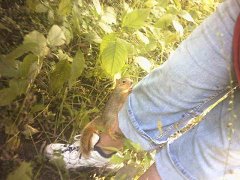
The cords where in there. Now I was told how to do this one and I did and had it right. So off I go. Now the gps kept getting me close by it, but I was still in the miles. Like .34ml. sort of thing. I'm driving around thinking ok I get this close but can't get any closer there has to be away. Then I remember there is a park by Petco on Alpine. Not to many know of it, but there is another geo in that park. So off I went and I was right. Now mind you I'm wearing white pants. Never ever do that when geocaching. A geo could be right out in the open and I'll still get dirty.
This cache was in a bit of woodsy part, but I went in anyways.. Got to theres a geo in there damn it.

Trying to get signal..


Into the park I go..


This was some "Blair Witch Shit"... that movie scares the shit out of me. At least
there was no body parts in there... Just the geo :)


Sunday, August 03, 2008

Benchmark NF0662

I decided today was the day to try to find a benchmark. This is the information
on this one.

Documented History (by the NGS)
1/1/1934 by CGS (MONUMENTED)
DESCRIBED BY COAST AND GEODETIC SURVEY 1934 AT FULLER. AT FULLER, KENT COUNTY, ON THE CHESAPEAKE AND OHIO RAILWAY, 70 YARDS SOUTH OF THE GRAND TRUNK WESTERN RAILROAD, AT THE PENNSYLVANIA RAILROAD BRIDGE OVER A CREEK, IN THE SOUTHEAST CORNER OF THE CONCRETE CAPSTONE AT THE EAST END OF THE CENTER PIER, 4 FEET EAST OF THE EAST RAIL, AND 3-1/2 FEET LOWER THAN THE TOP OF THE RAIL. A STANDARD DISK, STAMPED N 97 1934.


I have been to this area several times so I knew the place exactly. I didn't know exactly what I was looking for. I mean I had a idea but you know..lol

To the bridge I know...


See there across the way.. that's where I need to be..


I went on the bridge I'm use to and the gps said I was still like 30 some feet
from it and it was across the way. Now when I was here before I didn't notice the other bridge. It's hidden a bit so that's probably why. So I re-routed myself and
bushwacked my way to where I was assuming the way was to the bridge. I was right.
Now stepping on the old rails was a bit scary cause you know damn well they are old!!
Then I have the camera and the gps and my phone all at one time and I have to climb down off the tracks onto a cement slab to get a picture of it. All I could think climbing down is oh god let me get back up and please don't let me drop anything into the water.. Regardless it was fun!
I looked around a bit and bingo I found it. I was so excited. I know it don't take much..lol


The view from the benchmark..